
Terrain reconstruction
Drone 3D modelling: from point cloud to textured mesh
From aerial imagery to material your project teams can use: 3D models, point clouds and profiles to measure, analyse and share your site.
- Point cloud
- Textured mesh
- DSM
- Profiles and extractions

Processing · terrain model
Deliverables
Models for design and visualisation.
The same model shows the site to people who do not read plans, and measures precisely for those who design.
I Point cloud
A dense 3D base for measurement, feature extraction and visualisation.
II Textured mesh
A realistic model of the site to rotate and share in meetings.
III Surface model
The basis for analysing terrain, slopes and volumes.
IV Profiles and extractions
Sections, distances, heights, slopes and footprints, exported to your tools.
Photogrammetry
How a series of photos becomes a 3D model.
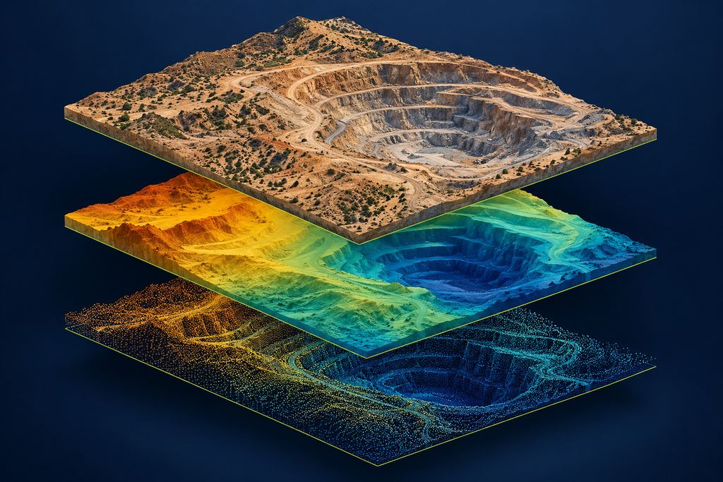
The drone takes hundreds of overlapping photos. Photogrammetry software finds the same points from one image to the next and calculates their position in space: that is the point cloud.
Tied to ground control points measured with GNSS RTK, the point cloud is accurate in position and height. From it we derive a textured mesh for visualisation, a surface model for analysis, and profiles or volumes for calculations.
For an interactive taste of what a 3D reading brings, try our demo on the Toubkal terrain.
Use cases
Applications of the 3D model.
- Roads, tracks and linear worksProfiles, slopes, footprints and structures along an alignment.
- Quarries and working facesGeometry of faces, benches and extracted areas.
- Platforms and buildings under constructionCompare as-built with design, stage by stage.
- Project communicationHelp a committee, funder or local residents understand a site.
3D demo · High Atlas
Read terrain in three dimensions.
Rotate the Toubkal massif, show the contour lines or the points of the digital terrain model. This is the kind of reading our drone flights produce on your site, at a much higher resolution.
Demo based on public data (SRTM, USGS · Mapzen Terrain Tiles), 100 m contours. This is not a SKY SURVEY survey. Sources
FAQ
3D modelling: your questions.
What is a point cloud?
It is a set of millions of points positioned in X, Y, Z (often coloured) that describe the surface of the site. You can measure distances, heights and volumes directly on it, or extract features for CAD.
Which software can open your 3D models?
Point clouds and models are exported in standard formats (for example LAS/LAZ for point clouds) supported by common CAD, GIS and 3D viewing software. We confirm formats with your teams at scoping.
How long does it take to get a 3D model?
It depends on the area covered, the level of detail and the deliverables requested. The delivery date is set at scoping, before the flight.
Your project
A proposal tailored to your site.
Share the location, survey area and required deliverables. We define the survey scope and site arrangements with you.