
Drone survey
- Images
- Elevation
- 3D
- Measurement and checks
- Reference and files
- DSM: ground, buildings, vegetation, stockpiles
- DTM: bare ground
- Terrain
- Photogrammetry
- A technique that reconstructs the geometry of an object or terrain from photos taken from several angles. By matching the same details across overlapping images, the software computes the position of each photo, then of millions of points.
- Orthophoto orthomosaic
- An aerial image assembled from many photos and corrected for distortions caused by relief and perspective. It is georeferenced: distances and areas can be measured on it, and it can be used as a base map in CAD or GIS.
- GSD ground sampling distance
- The distance on the ground covered by one image pixel, for example 2 cm. The smaller the GSD, the finer the detail. It depends on the camera and the flight height: about 2.7 cm at 100 m for the DJI Mavic 3 Enterprise.
- DSM digital surface model
- An elevation model of everything the drone sees: ground, buildings, stockpiles, vegetation, machinery. It is the surface used for volume calculations.
- DTM digital terrain model
- An elevation model of the bare ground, obtained by removing buildings, vegetation and objects from the DSM. It is used for contours, profiles and earthworks design. Under dense vegetation the ground is not visible to photogrammetry, so the DTM is interpolated there.
- Point cloud
- A set of millions of X, Y, Z points, often coloured, describing the surface of the site. You can measure on it directly, extract features from it or derive DSMs, DTMs and meshes.
- 3D mesh
- A continuous surface made of triangles, textured with the photos. It is the most realistic representation of the site, ideal for visualisation and communication.
- LiDAR laser scanning
- A sensor that measures distances with laser pulses. Some pulses pass through gaps in the foliage, so the ground can be reached under sparse vegetation, where photogrammetry only sees the canopy.
- Contour lines
- Lines joining points of equal elevation, drawn at a regular interval. They show relief on a two-dimensional plan.
- Long and cross sections
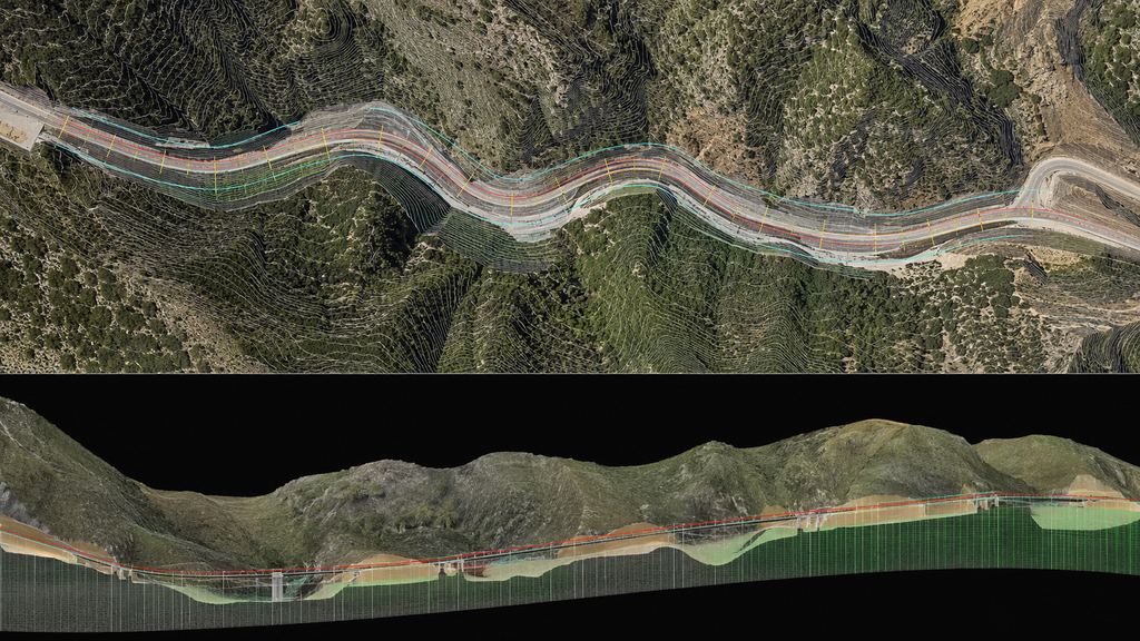
- Vertical cuts through the ground along an alignment (road, track, channel) or perpendicular to it. Essential for linear projects and earthwork calculations.
- Volume survey
- The calculation of a volume between two surfaces: a stockpile and its base, the ground and its design, or two successive surveys. See our guide to drone volume surveys.
- Ground control point GCP
- A target placed on the ground and surveyed precisely with GNSS RTK or a total station. Control points fix the model in the project coordinate system.
- Check point
- A point surveyed on the ground but not used in the adjustment. It provides an independent check of the model’s accuracy.
- RMSE root mean square error
- An accuracy measure computed on check points: the square root of the mean of the squared differences between the model and the ground. It is stated separately for horizontal and vertical accuracy.
- RTK and PPK
- GNSS correction techniques, in real time (RTK) or after the flight (PPK), that give centimetre-level positions to the drone or to a ground receiver.
- Overlap
- The shared area between two neighbouring photos, along the flight line (forward overlap) and between flight lines (side overlap). For the general case, Pix4D recommends at least 75 % and 60 %.
- Georeferencing
- Assigning real-world coordinates in a reference system to every pixel or point.
- Coordinate system
- The reference frame in which positions are expressed. In Morocco the Lambert conformal conic projection is divided into four zones: Nord Maroc, Sud Maroc, Sahara Nord and Sahara Sud. The historical Merchich datum is still widely used (for example EPSG:26191 for the North and EPSG:26192 for the South, which covers Souss-Massa south of 31°30′ N), alongside ANCFCC’s Moroccan Fundamental Network tied to ITRF, and UTM on WGS 84. The system is agreed at the start of the project.
- Delivery formats
- GeoTIFF (orthophoto, DSM, DTM), LAS 1.4 or its lossless compressed form LAZ (point clouds), OBJ (meshes), DWG/DXF (plans and contours for CAD), KML/KMZ (viewing in Google Earth), PDF and Excel (reports and tables).
Sources
- DJI Enterprise, Geospatial Solutions FAQ (Mavic 3E GSD)
- Pix4D, image acquisition plan and overlap
- ANCFCC, Morocco’s planimetric geodetic network
- EPSG:26191, Merchich / Nord Maroc
- EPSG:26192, Merchich / Sud Maroc
- Library of Congress, LAS 1.4 format (ASPRS)
Manufacturer figures and published orders of magnitude: the accuracy of a given project is demonstrated on its own check points.